Call Us 24/7 For A Free Legal Consultation

All Of Colorado’s Most Dangerous Roads And Highways

Top Rated Colorado Springs Lawyers

Exceptional Results Require Outstanding Attorneys

New Background Pic No Logo

Millions Of Dollars Recovered Every Year For Our Satisfied Clients

Awards & Associations

National Trial Lawyers Top 40 Under 40 Award Badge
Martindale Hubbel Distinguished Peer Rated For High Professional Achievement In 2018 Badge
Colorado Trial Lawyers Association Member Badge
Colorado Bar Association Member Badge
Armed Citizens Legal Defense Network Badge

A Guide To Colorado's Most Dangerous Roads

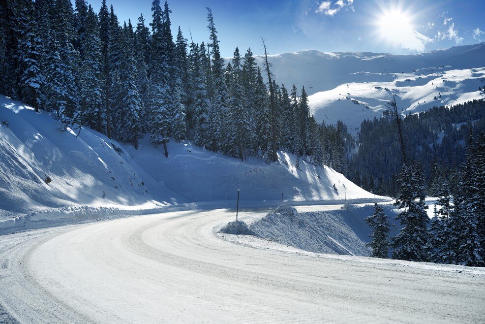
Colorado’s widely varying landscape provides drivers an incredibly diverse range of views of the Rocky Mountains from any part of the state, but the roads you travel to get there aren’t always as pleasant. With drastic elevation changes throughout many of these roads, weather can change very quickly and put drivers in unwanted dangerous situations. 
Colorado's Most Dangerous Roads

We have compiled a list of all of Colorado’s most dangerous roads to drive, from heavy traffic areas to medium and low traffic roads that have proven to be very treacherous for many drivers through the years. In the event that you are driving down any of these roads and another driver is operating their vehicle negligently and causes an accident, get in touch with the best car accident attorneys in Colorado Springs right away for a no-cost consultation.

Most Dangerous Medium Traffic Roads In Colorado

These are the roads less travelled than the main highways like I-70 and I-25, but are still very dangerous for drivers. The amount of traffic isn’t extremely high, but the road conditions and ease of driving is significantly higher on small mountain roads that wind deep into the Rocky Mountains. Don’t get caught out on these roads without safety gear and an expert level driver or you might end up needing a nearby car accident attorney help to navigate your accident claim.
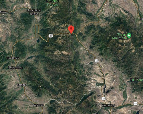
Rabbit Ears Pass

Rabbit Ears Pass
9,426 ft ~
Connects Kremmling and Steamboat Springs via highway 40 Rabbit Ears Pass is a section of US 40 between Kremmling, CO and Steamboat Springs, CO that peaks around 9,400 ft of elevation. This road is a very popular spot for hikers, snowmobiling, cross-country skiing and more as the road is very near the resort area making it easy to access. This part of US 40 has steep drop offs and gets a lot of snow, so make sure to check the weather and prepare your vehicle before making the trip.

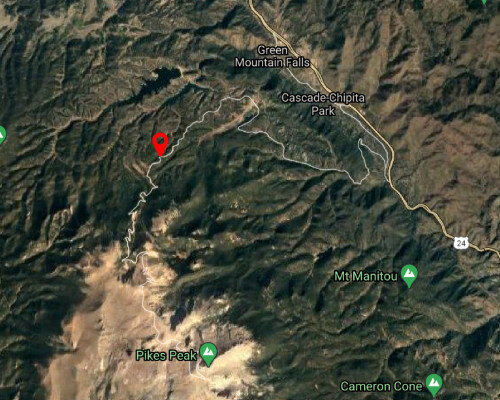
Pikes Peak Highway

Pikes Peak Highway
14,115 ft ~
You may have heard of the Pikes Peak International Hill Climb before, which takes place right here outside of Colorado Springs. The road varies from long and winding to tight turns at very slow speeds. The summit of Pikes Peak is at 14,115 ft and has an incredible view of the Colorado plains from up top. Don’t get scared though, many of the turns towards the top have steep cliffs and NO guardrails for safety. It’s scary even when driving a car slowly, so you can only imagine how crazy it must be for racers to speed up this mountain as fast as possible. Take your time and enjoy the view on the way up as this drive is spectacular, yet very dangerous for novice drivers. The descent is so steep that there is even a mandatory brake temperature checkpoint halfway down the mountain.

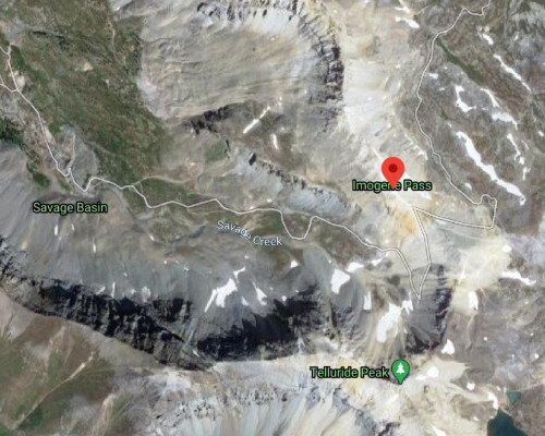
Imogene Pass

Imogene Pass
13,114 ft ~

Telluride is a beautiful place that is world famous for its skiing but getting there is not an easy task. If you are coming south from Ouray, CO to Telluride, CO the most direct route is to take Imogene Pass through the mountains(though it’s not a very direct route at all). This road is very tight and most of the distance is above 13,000 ft high, so you know the weather is unpredictable up there. Mix that with high winds and icy roads and your drive is going to be stressful to say the least.
Mount Evans Scenic Byway

Mount Evans Scenic Byway
14,160 ft ~

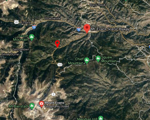
Mount Evans is known for its paved road all the way to the top of a 14,000 ft mountain that is accessible during the summer months to avoid unnecessary accidents. Mount Evans Scenic Bypass has been carefully crafted into the mountain to provide a safe road for tourists to travel easily to the top of a 14er in Colorado, which is a limited task as most mountains do not have access roads that go that high. Starting from the Idaho Springs Visitor Center just off of I-70, the Byway takes you straight to the top of Mount Evans, no hiking required. Get ready for a beautiful drive, but don’t look over the edge!
Argentine Pass

Argentine Pass
13,207 ft ~
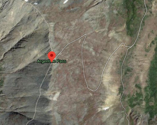
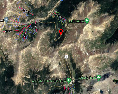
Connecting Clear Creek County to Summit County, Argentine Pass is a narrow road that just keeps getting narrower as you go. Much of the road is dirt and is not well maintained, so be sure you have 4 wheel drive if attempting to take this road in the winter months, chains and a shovel aren’t a bad idea either for this one. There also aren’t many towns nearby, with the largest nearby town being Arapahoe Basin ski area, so keep that in mind when gassing up or off-roading heavily.

Loveland Pass – Highway 6

Loveland Pass
11,991 ft ~

It’s a very common thing for people stuck in traffic on I-70 going to the mountains to get off at Loveland Pass(Highway 6) and cruise over to Arapahoe Basin or take the backway to Keystone Resort. More often than not, during winter weekends, too many people take this route and the icy razorback turns end up causing an even bigger traffic jam, so make sure your vehicle is prepared for winter driving to avoid accidents. Wrecks happen frequently through this area and lots of people get stuck so make sure to check live traffic data before taking this detour.
Gold Belt Scenic Byway

Gold Belt Scenic Byway
9,500 ft ~
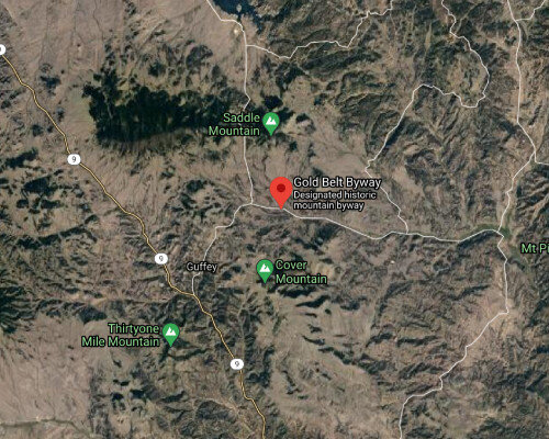
This historic mountain byway is called the Gold Belt Scenic Byway and is an incredible sight, ranging from mountains to red canyons and connecting numerous towns like Canon City, Florence, Cripple Creek and Florissant. The road is not very forgiving though and in some parts is only wide enough for one car even though it is supposed to fit two. Some notable features would be the one-way narrow tunnels through the mountains and the bright red curved bridge you go over. It’s a beautiful drive, but keep your eyes on the road as this route gets sketchy quickly.

Coal Bank Pass

Coal Bank Pass
10,640 ft ~
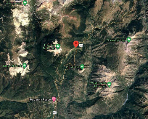
Coal Bank Pass is a section of the Million Dollar Highway between Silverton, CO and Durango, CO passing by Engineer Mountain and Potato Hill along the way. The elevation isn’t crazy but does sit around 10,600 ft up so the air is pretty thin and may be an issue for some out of towners. Carved out into the side of a mountain and surrounded by trees in every direction, this pass is commonly closed from avalanches covering the road or just down right treacherous driving conditions. Most areas don’t have guardrails and the cliffs are so steep you can’t see the edges.

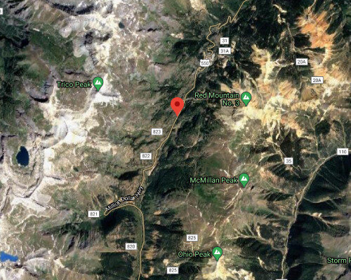
Red Mountain Pass

Red Mountain Pass
11,018 ft ~

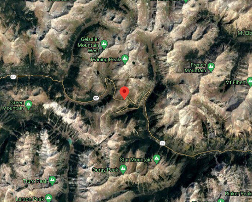
Another dangerous section of the Million Dollar Highway is Red Mountain Pass that goes all the way up to 11,018 ft at its summit and connects Silverton, CO to Ouray, CO through the mountains. This pass is even worse than the Coal Bank Pass, as it is extremely narrow. So narrow in fact that there is no room for guardrails, so you should probably keep your large vehicles off of this road. With very steep cliffs on your side, this road will make your stomach turn so keep it slow and you should be able to get through safely.
Oh My God Road – Two Brothers Road

Oh My God Road Two Brothers Road
9,383 ft ~

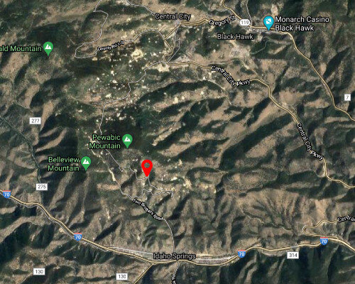
Connecting Idaho Springs at I-70 to Central City, Oh My God Road has rightly earned its name although its proper name is Two Brothers Road as you will see on a map. Very narrow roads and steep cliffs mean you need to take this one slow and steady to come out the other end safely. If you aren’t feeling up to it, there is another route up Central City Parkway that won’t have you scared to look out the window.
Wolf Creek Pass

Wolf Creek Pass
10,856 ft ~
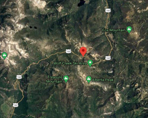
Part of US 160 between South Fork and Pagosa Springs, Wolf Creek Pass is a famous part of Highway 160 that is full of switchbacks, blind turns, hazardous conditions and steep hills. It has incredible views surrounded by mountains just like most other Colorado roads, but in bad weather conditions it’s best to sit this one out. Wolf Creek Pass is your entry road to Wolf Creek Ski Area from Pagosa Springs to the south or from South Fork to the north.

Monarch Pass

Monarch Pass
11,312 ft ~
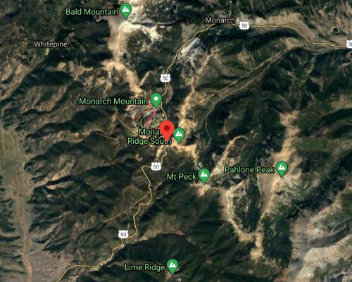
If you are looking for a nearby small mountain to ski in the winter that is close to the southern cities like Pueblo and Colorado Springs, Monarch Mountain is a popular destination. To get there, you’ll have to take Monarch Pass to get to the slopes however, the journey down the winding mountainous road to get there is an adventure in itself. The views are stunning the entire time as you drive through a valley surrounded by 12,000+ ft peaks but stay alert as the road conditions can get pretty bad during winter months.

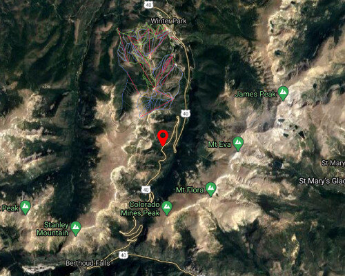
Berthoud Pass

Berthoud Pass
11,307 ft ~
Winter Park is a small ski mountain just outside of Denver that many residents travel to quite frequently. The road from Denver takes you up Berthoud Pass that gets up to 11,307 ft high and often gets jammed up with traffic when snow comes in. Carved out into the side of the mountains, avalanches and snow slides are common and can easily block off the road for hours. Make sure to check your tires and bring chains because this road is going to test your abilities.

Independence Pass

Independence Pass
12,095 ft ~
Only open between June and September, Independence pass is a thrilling path to get to Aspen from Highway 24. It consists of blind corners, narrow paths and steep cliffs at an altitude of 12,095 ft. If you prefer mountain roads with guardrails then this road is not for you, those that like the thrill will enjoy zero guardrails the entire way through on your way to Aspen or Snowmass.

Trail Ridge Road

Trail Ridge Road
12,000 ft ~
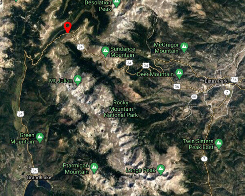
For those that want to drive through Rocky Mountain National Park, Trail Ridge Road is your path through during summer, taking you from Estes Park all the way around to Grand Lake. The road varies in elevation as you wind through Rocky Mountain National Park and you won’t be able to access the road during winter but if you come during summer months you can likely see a lot of wildlife on your trip. It’s a beautiful drive but take it slow as there are many hairpin turns and typically a decent amount of traffic during busy seasons.

We Help People Injured In Car Accidents Get Compensation

Background
12,000 ft ~

Many people get in car accidents everyday throughout Colorao, but most of them have no idea how a lawyer can help them with their case. If you have been injured in a car accident, call us right away and we can talk through your accident and find how to recover compensation for your injuries and any other damages. If you have been in a car accident, don’t let your fair compensation walk away from you, contact the best car accident attorneys in Colorado for a free consultation.
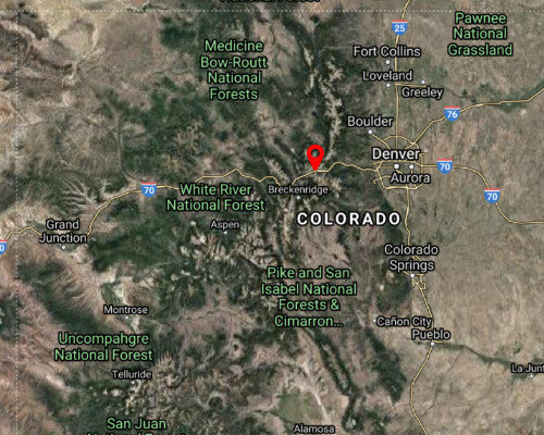
Most Dangerous High Traffic Roads In Colorado

Interstate 70 – Resort Gateway

Interstate 70
11,158 ft at Eisenhower Tunnel

Stretching from Utah, through Colorado and all the way out to Maryland, I-70 is a famous interstate highway that is widely used every day for local and interstate travel. Mostly flat in some areas, Colorado gives drivers the most treacherous section of I-70 through the Rocky Mountains. Starting just west of Denver, the elevation rises steeply and turns constantly through the mountains. Starting just west of Denver, the elevation rises steeply and turns constantly through the mountains. Extreme weather is common in this section, especially where you meet the Eisenhower tunnel at 11,518 ft of elevation where white out conditions are common and extremely dangerous when traveling at 55mph. Going through this part is a necessity if you want to make it to all of Colorado’s famous ski resorts. Other heavily trafficked sections across the downtown and Denver metro area are very congested at rush hour times and usually still busy late into the night so be sure to use caution.
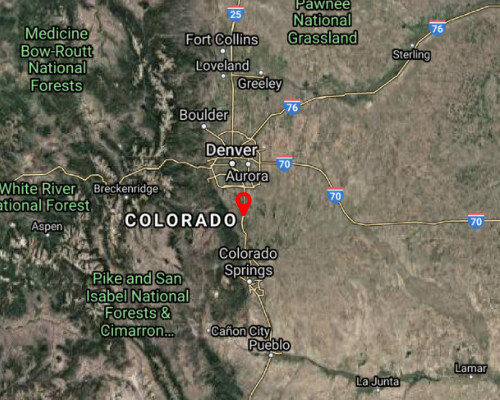
Interstate 25 – Front Range Corridor

Interstate 25
6,000 ft ~

Ahh, the dreaded I-25 corridor. We have all driven this nightmare of a highway with its neverending construction and 2 lanes to stuff massive amounts of commuter traffic into and I’m sure we can all agree that the expansion projects and improvements are much needed for our constantly growing state. This road goes north and south across the entire state of Colorado with a typical speed limit of 75 mph(except in some areas) that allows you to move quickly across the front range. Thousands of drivers use this highway every day to commute between Denver, Colorado Springs, Castle Rock, Pueblo and more make rush hour a very dangerous time to be on I-25 with numerous car accidents happening every single day.
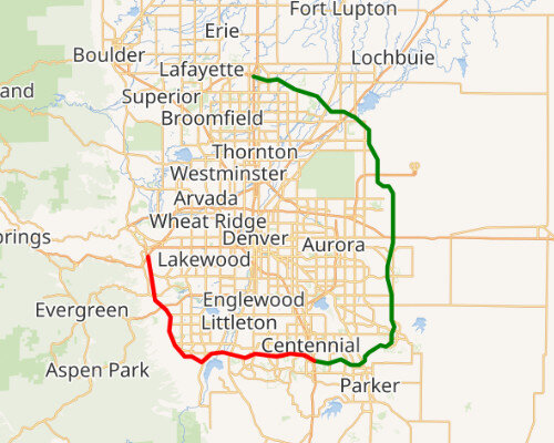
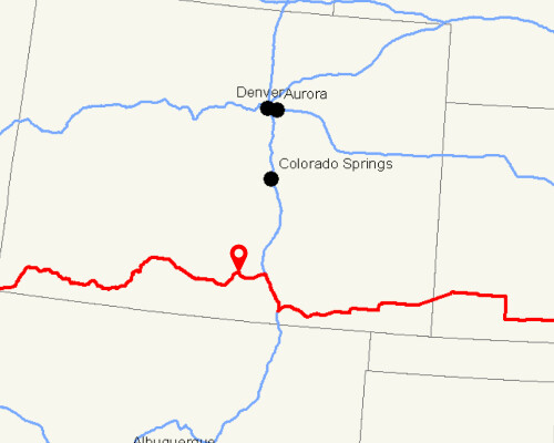
State Highway 470 – Denver Beltway

State Highway 470
5,280 ft ~
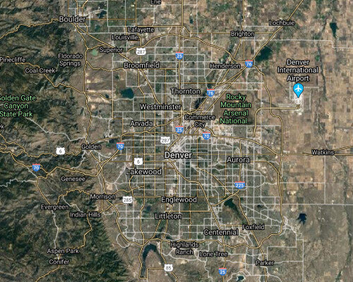
If you’ve ever gone to the Denver International Airport in your life, you’ve probably taken the fast route by using Highway 470 to avoid all of the heavy traffic on other main highways. This road loops around the Denver metro area, with c-470 starting near Golden, CO just off of I-70 and looping all the way down to Centennial, CO and then running north past DIA and ending near Lafayette, CO. This highway gets tens of thousands of vehicles traveling across it every day and has become a very dangerous road during rush hour traffic.

Highway 160 – Southern Passage

Highway 160
10,857 ft ~
Stretches across the entire southern edge of Colorado passes through the mountains Highway 160 is a very popular road for southern Colorado residents as it ranges across the entire southern border of Colorado, winding through high elevations and tight turns. Traveling this road will take you through Pagosa Springs, Durango, the Continental Divide in Wolf Creek Pass and many other towns. It is a highly dangerous road according to data that shows there is an irregularly large amount of DUI arrest made on this road. That combined with such varying terrain is a recipe for disaster and should be driven with caution.

US 550 – Million Dollar Highway

Us 550
10,000 -11,000 ft ~
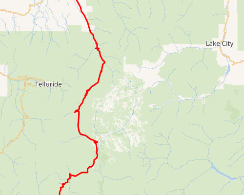
Runs from Albuquerque NM to Montrose CO. Numerous famous passes along the way. US Route 550 is commonly referred to as the Million Dollar Highway, but typically it is the 25 mile stretch from Ouray, CO to Silverton, CO that is referred to as the Million Dollar Highway. This section of road goes through 3 mountain passes, all with elevations exceeding 10,000 ft with very tight turns and usually boasting snow/ice covered roads. The mountain views are incredible in this area, but don’t take your eyes off the road, as the roads drop off very steeply in many different areas, some of them without guardrails for protection. With turns so tight that 10mph speed limits are introduced in some spots, you can be sure that this road is not for the amateur driver and should be traveled by only experienced drivers who are comfortable driving in snow and icy conditions.

Denver Metro Main Roads

Denver Metro Main Roads
Denver’s massive population throughout the metro area means tons of rush hour traffic every single day across the city. Add cell phones, coffee, food, passengers and more to that and you have a perfect recipe for numerous car accidents every day, at all times of the year. Add some snow on top of these main roads and you will see massively increased travel times as accidents happen constantly when Denver gets a decent amount of snow. Some of these most dangerous main roads are as follows: Sheridan Blvd Colfax Ave Colorado Blvd Wadsworth Blvd

Colorado Springs Main Roads

Colorado Springs Main Roads
Colorado Springs has seen a huge uptick in people moving to the area over the last few years, from people fleeing Denver’s high housing prices to out of towners looking for an outdoor friendly place to live. The roads in Colorado Springs have not grown at the same pace as the residents, so our main roads have become much more congested across many areas. Some of the most highly trafficked roads in Colorado Springs are as follows: Powers Blvd Academy Blvd Fountain Ave Union Blvd Woodmen Rd

If You Get In An Accident, We Are Here To Help You Through The Process

This article may tempt you to go drive all of these roads and we encourage you to explore this beautiful state, but please drive with caution as many of these roads have no room for error. In the unfortunate event that you are involved in an accident during your trip, you’re not sure what to do after a car accident that’s not your fault or even on your daily commute to work, get in touch with a car accident lawyer near you right away so they can make sure you are compensated fairly for your injuries. At Rector Stuzynski LLC, we have decades of experience helping car crash victims get back to their normal lives and we pride ourselves in helping our fellow neighbors, so give us a call for a free consultation any time at (719) 578-1106.

Areas We Serve

We serve clients injured anywhere throughout the state of Colorado, but we focus on residents of these areas: Colorado Springs, Manitou Springs, Fountain, Briargate, Monument, Black Forest, Pueblo, Canon City, Larkspur, Security-Widefield, Peyton, Castle Rock, Teller County, El Paso County, Elbert County, Park County, Douglas County and beyond.