
Colorado’s diverse landscape offers incredible views of the Rocky Mountains, but the roads you travel to get there are not always forgiving. With steep elevation changes, tight turns, narrow lanes, and rapidly changing weather, many roads across the state can quickly become dangerous.
We have compiled a guide to some of Colorado’s most dangerous roads, from busy highways to remote mountain passes that challenge even experienced drivers. If you are injured because another driver was operating a vehicle negligently, speak with an experienced car accident attorney in Colorado Springs as soon as possible.
These roads do not carry the same volume as major highways like I-70 or I-25, but they can be even more dangerous in the wrong conditions. Many of them involve steep drop-offs, blind curves, narrow lanes, and sudden weather changes that leave very little room for error.
Elevation: 9,426 ft
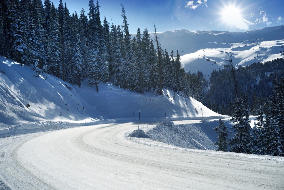
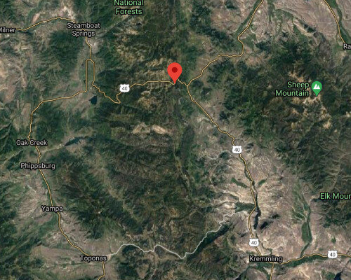
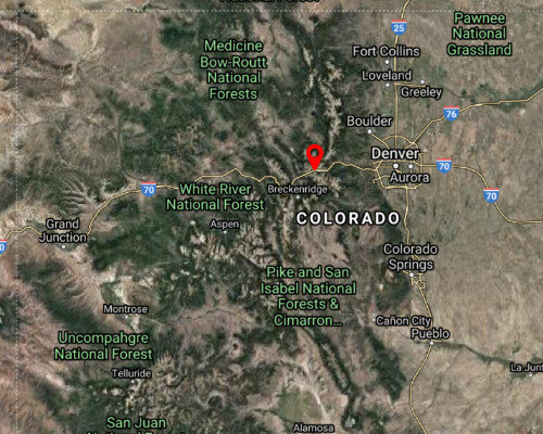
Located along US 40 between Kremmling and Steamboat Springs, Rabbit Ears Pass is a well-known mountain route that attracts drivers heading to outdoor recreation areas year-round. It is especially popular for access to hiking, snowmobiling, and skiing.
The road can become dangerous very quickly in winter due to heavy snowfall, steep grades, and reduced visibility. Drivers should check the forecast and make sure their vehicle is properly prepared before attempting the pass.
Elevation: 14,115 ft
Pikes Peak Highway is one of the most famous scenic drives in Colorado. It offers incredible views, but it also comes with serious hazards. The road features tight switchbacks, steep drop-offs, and sections with little or no guardrail protection.
The descent is particularly dangerous due to the grade, which is why brake checks are mandatory on the way down. Even experienced drivers need to stay alert the entire time.
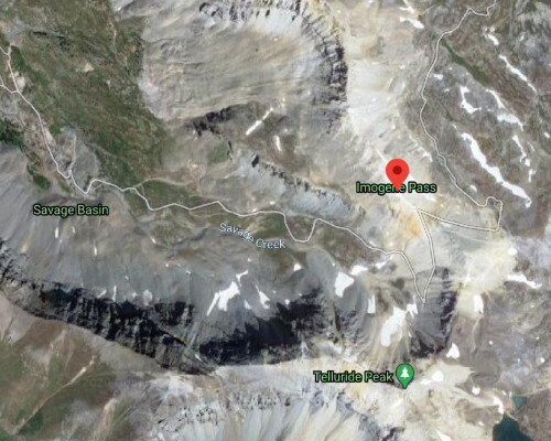
Elevation: 13,114 ft
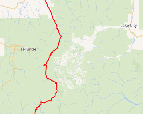
Connecting Ouray and Telluride, Imogene Pass is extremely narrow and reaches very high elevations. This route is known for rough terrain, sharp turns, and highly unpredictable weather.
Because much of the road sits above 13,000 feet, conditions can become dangerous with little warning. It is not a road for novice drivers or vehicles that are not properly equipped.
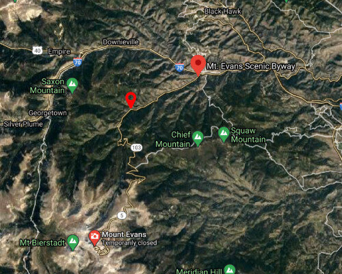
Elevation: 14,160 ft
Mount Evans is famous for being one of the highest paved roads in North America. It provides vehicle access to a 14,000-foot summit, which is rare in Colorado.
Although the road is paved and popular with tourists, it still includes steep edges, narrow sections, and extreme elevation. Drivers should not let the views distract them from the road.
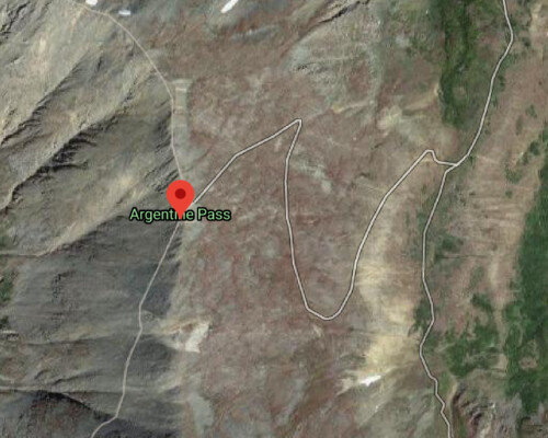
Elevation: 13,207 ft
Argentine Pass connects Clear Creek County to Summit County and becomes narrower as you climb. Much of the road is dirt and is not especially well maintained.
In winter and shoulder seasons, drivers should expect challenging conditions and limited nearby services. A high-clearance or four-wheel-drive vehicle is often necessary, and extra supplies are a smart idea.
Elevation: 11,991 ft
Loveland Pass is a common alternate route for drivers trying to avoid traffic on I-70. During winter weekends, that often means this pass becomes crowded and dangerous.
Icy turns, heavy traffic, and frequent wrecks make this road especially hazardous in winter. Drivers should make sure their vehicle is prepared for winter driving before attempting it.
Elevation: 9,500 ft
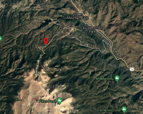
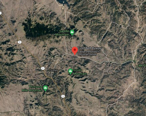
This scenic route connects communities such as Canon City, Florence, Cripple Creek, and Florissant. It offers beautiful mountain and canyon views, but it is far from an easy drive.
Some sections are extremely narrow and feel as though they were barely carved into the terrain. Tunnels, bridges, and winding mountain sections make this route one where drivers need to remain fully focused.
Elevation: 10,640 ft
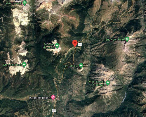
Coal Bank Pass is part of the Million Dollar Highway between Silverton and Durango. It is surrounded by steep mountains, changing weather, and sections without guardrails.
The road can become treacherous due to snow, avalanches, and low visibility. It is a beautiful drive, but not one to take lightly.
Elevation: 11,018 ft
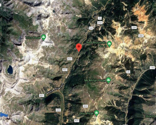
Another notorious section of the Million Dollar Highway, Red Mountain Pass is narrow, steep, and intimidating even in good weather. There is very little room for error.
Large vehicles should be especially cautious here, and drivers who are uncomfortable with mountain roads may want to consider avoiding it altogether.
Elevation: 9,383 ft
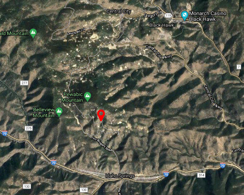
Connecting Idaho Springs to Central City, this road has earned its reputation honestly. It is very narrow, includes steep drop-offs, and demands slow, careful driving.
If you are not comfortable with this kind of road, there are less stressful ways to reach Central City.
Elevation: 10,856 ft
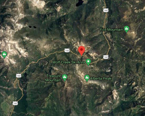
Located on US 160 between South Fork and Pagosa Springs, Wolf Creek Pass is famous for sharp switchbacks, steep hills, and winter hazards. It is also a key route to the Wolf Creek Ski Area.
Bad weather can make this road especially dangerous, and drivers should be prepared before attempting it during storm conditions.
Elevation: 11,312 ft
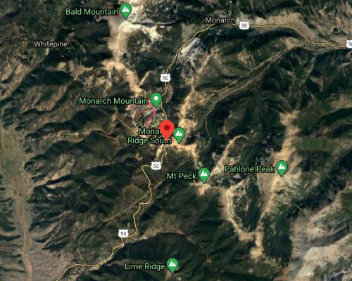
Monarch Pass is a popular route for travelers headed toward Monarch Mountain and other areas in southern Colorado. It offers stunning scenery but also includes steep grades and winter driving challenges.
Road conditions can deteriorate quickly, especially in snowy or icy weather, so drivers should stay alert and avoid underestimating the route.
Elevation: 11,307 ft
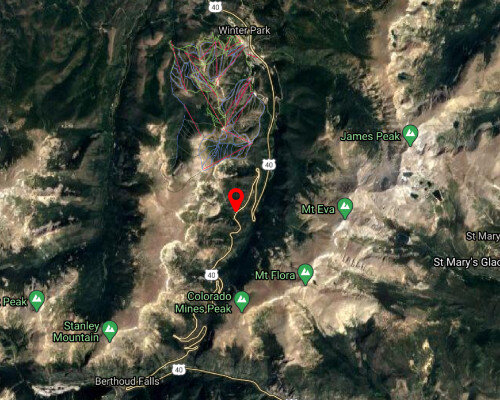
Berthoud Pass is a major route to Winter Park and is heavily traveled during ski season. Avalanche risk, snow slides, and traffic backups make it particularly dangerous during winter storms.
Drivers should bring chains when necessary and make sure their tires and brakes are ready for mountain conditions.
Elevation: 12,095 ft
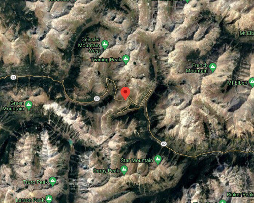
Open only during warmer months, Independence Pass is a narrow, cliffside road that offers a dramatic route toward Aspen. It is known for blind corners, steep drops, and a lack of guardrails.
Drivers who dislike tight mountain roads may find this route particularly stressful.
Elevation: 12,000 ft
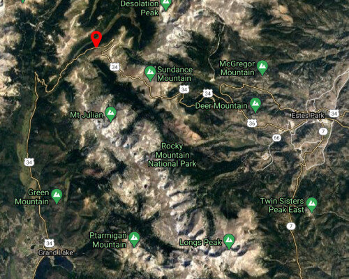
Trail Ridge Road cuts through Rocky Mountain National Park and is one of the most scenic drives in the state. It is typically open only during the summer season.
Although it is popular with tourists, it still includes sharp turns, changing elevation, and a fair amount of seasonal traffic. Slow, cautious driving is essential.
Many people are injured in car accidents throughout Colorado every day, and most of them are not sure what a lawyer can actually do to help. If you have been hurt in a crash, we can help you understand your options and work to recover compensation for your injuries and other damages.
If you have been injured in a collision, contact the best car accident attorneys in Colorado for a free consultation.
CALL FOR A FREE CONSULTATION
(719) 578-1106
These roads carry significantly more traffic, which increases the chances of collisions caused by congestion, speeding, distracted driving, and weather-related hazards.
Elevation: 11,158 ft at Eisenhower Tunnel
I-70 is one of the most heavily traveled highways in Colorado and one of the most dangerous. The mountain section west of Denver includes steep grades, sharp curves, frequent congestion, and severe winter weather.
Whiteout conditions, chain restrictions, and ski traffic all make this route especially dangerous during the colder months.
Elevation: 6,000 ft
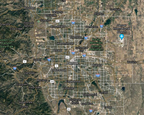
I-25 is the primary north-south corridor through Colorado and carries enormous volumes of commuter and freight traffic. Ongoing construction, congestion, and high speeds make rush hour especially dangerous.
Drivers moving between Denver, Colorado Springs, Castle Rock, and Pueblo know how quickly a normal commute can turn into a multi-vehicle accident scene.
Elevation: 5,280 ft
Highway 470 loops around the Denver metro area and is commonly used to avoid congestion on other major highways. Even so, it sees heavy daily traffic and can become dangerous during peak travel times.
Frequent merging, high speed travel, and commuter congestion all contribute to the risk.
Elevation: 10,857 ft
Highway 160 stretches across southern Colorado and passes through a wide variety of terrain, including mountain sections and steep grades. It is heavily used by southern Colorado residents and visitors alike.
Its combination of elevation, curves, weather exposure, and impaired driving concerns make it a road that demands caution.
Elevation: 10,000 to 11,000 ft
The Million Dollar Highway is one of Colorado’s most famous drives and one of its most intimidating. The stretch between Ouray and Silverton includes steep cliffs, very tight turns, and sections without guardrails.
It is not a road for inexperienced drivers, especially in snow or ice.
Denver’s high population and heavy commuter traffic create dangerous conditions on many of its main roads. Distracted driving, weather, and congestion contribute to frequent crashes.
Some of the roads that regularly see heavy traffic and dangerous conditions include Sheridan Boulevard, Colfax Avenue, Colorado Boulevard, and Wadsworth Boulevard.
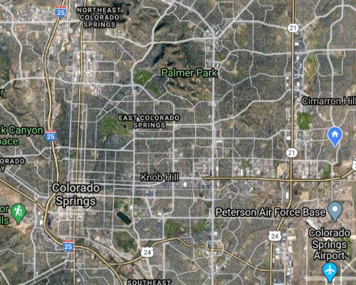
Colorado Springs has grown rapidly, and the road network has not always kept pace. As a result, many of the city’s major roads have become far more congested and dangerous.
Some of the most heavily traveled roads in Colorado Springs include Powers Boulevard, Academy Boulevard, Fountain Avenue, Union Boulevard, and Woodmen Road.
This guide may inspire you to explore more of Colorado, and we absolutely encourage that. Just remember that many of these roads leave very little room for error. If you are involved in an accident and are not sure what to do after a car accident that’s not your fault, reach out to an experienced car accident lawyer near you as soon as possible.
At Rector Stuzynski Law Firm, we have decades of experience helping injured crash victims pursue fair compensation and move forward after serious accidents.